GPS Interference Detection Across Domains

Detect and map GPS jamming and spoofing activity using near–real-time GNSS signal measurements at scale. PNT-SA analyzes Global Navigation Satellite System (GNSS) signal behavior across thousands of satellite transmissions to detect, locate, and characterize radio-frequency interference (RFI) in both terrestrial and orbital environments.
Website acticvity

Key Features

Real-Time GPS Interference Monitoring

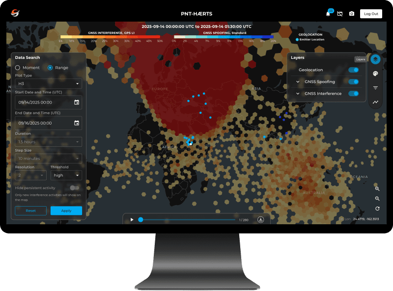
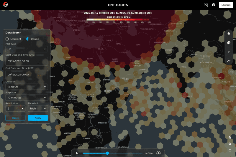
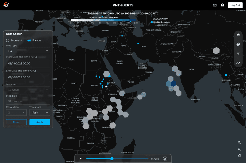
Continuously analyzes near real-time GNSS signal measurements to detect spoofing and jamming incidents with high temporal and spatial resolution.

Signal Attribution & Characterization

Characterizes interference patterns and supports locating sources by frequency, origin, and impact area.

Historical Pattern Analysis

Review time-series interference patterns to support investigation, attribution analysis, and trend assessment.

Example Use Cases

Icon

U.S. Space Force & Allied Agencies

Monitor global hotspots for GNSS interference that may affect mission-critical systems.
Icon

Satellite Operators

Identify potential interference that may affect fleet communication or navigation.
Icon

Policy & Coordination Bodies

Access regional heatmaps of detected jamming and spoofing activity. Support regulatory analysis and risk-sharing initiatives.
Icon

Commercial Risk Firms

Use interference pattern data to inform insurance models for satellite navigation and timing payloads.

Featured Capabilities

View our Products
Icon

Seradata

The industry’s trusted source for satellite, launch, and space event intelligence. With a continuously updated catalog and deep historical archive, it’s the go-to reference for insurers, operators, and analysts worldwide.

Icon

Agatha AI

AI-driven insights engine for detecting, analyzing, and explaining anomalies in space object behavior. Leverages advanced analytics and machine learning to identify outliers, trends, and emerging risks early enough to support informed operational decisions.

Icon

Data Catalog

Central data hub connecting the Slingshot Global Sensor Network (SGSN) and Sovereign Space Object Tracking (SSOT). Provides continuous, high-precision orbital intelligence through near real-time sensor data, advanced processing, and on-demand tasking for mission-ready awareness.
Icon

Digital Space Twin

An interactive 3D environment for modeling and visualizing near real-time orbital data. Explore missions, maneuvers, and conjunctions in a dynamic spatial context built for operators, analysts, and educators alike.


Icon

Developer Docs

Centralized documentation hub for APIs and future MCP server integrations supporting Slingshot’s ecosystem. Built for engineers, integrators, and researchers building with Slingshot data.